Cultivated Mountains
The Place
Location: Boise Basin, Idaho
Subjects: mining; forestry; biodiversity
Time: Specific events in the 1860's, but broader focus on pre - colonial development and modern day
Cultivated Mountains
by Grady Lynch
For roughly 12,000 years, the Boise Basin was inhabited by primarily three main groups, The Shoshone, Bannock, and Northern Paiute tribes. Long practices of intentional burns and cultivation had expanded the coniferous forests across the divide, increasing the temperate climate of the region and stabilizing the often harsh conditions of the local climate. Flora and fauna flourished due to these practices,and created rich soils that sustained and improved forest health.1 This intentional burning of pine forests prevented overgrowth and overpopulation, which also reduced the severity of wild or catastrophic fires.
Most western Americans grew up being told that the forests and mountains of the frontier were untouched and pristine. As nature intended, however this wasn’t true even 600 years ago and long before the European “discovery” of the new world. The truth is the beauty of these mountains, the diversity of life that lives in it was maintained and improved through thousands of years of Native American stewardship.
Traditionally in most cultures the use of intentional forest fires was to clear the forest for more grasslands and agriculture. However most trees of the divide, often coniferous, have evolved to use the fires to seed the new generation; long before humans even existed.
The strategic burns provided opportunities to expand the forests or clear them to create pockets of marsh or grassland. The cultivation of camas in particular provided water and bedding sources for local fauna; those prairies continue to sustain wildlife to this day.2
The presence of gold in the Boise Basin was not known until a Native American of the Bannock tribe told a miner near Elk City about seeing yellow metal in the local waters as a child. News quickly spread about the gold in the area and by 1862 roughly 20,000 people arrived to join the new gold rush. “To combat the Indian menace, a military post was established in 1863 near the present site of Boise.”3 Following the rush of miners, this military post continued to suppress Native American tribes’ attempt to protect their territory. By 1864, Native American Influence in the basin had been pushed back to the corners of the Boise Basin.4
It is important to note that these lands exploited for gold continue to damage the waterways today. Ancestral hunting grounds were eroded away in search of gold. Fields of camas were taken and used for European crops. Mining tailings, pesticides, and invasive species are rampant throughout the Basin. This mining history has eroded thousands of years of maintenance and balance of ecological life.
The immense biodiversity of the region is largely a result of intentional efforts made by Native Americans.5 Many species may have gone extinct if not for work done by Native Americans to create such a healthy biosphere. Our influence, a growing non-Native population, has done much to damage the once-healthy ecosystem of the region. Even when forests are left alone, they increase in density, pushing out other plants and the animals that feed on them, making the next fires that occur more catastrophic. In order to keep these biomes healthy, we have to be active and wise in our efforts to sustain their existence.
Works Cited
-
History of idaho territory, showing its resources and advantages. Google Books. https://books.google.com/books?id=1B1OAQAAIAAJ&pg=PA211#v=onepage&q&f=false
-
Idaho State Historical Society, Bird’s Eye View of Grimes Creek and Vicinity, 1884, https://idahohistory.contentdm.oclc.org/digital/collection/p265501coll1/id/73/rec/3
-
United States Forest Service, Boise National Forest - Archaeology and Cultural Resources, March 23, 2025, https://www.fs.usda.gov/r04/boise/natural-resources/arch-cultural ↩
-
Kaleb Roedel, The washoe tribe brings back cultural fire to restore forests, plants amid climate change. Boise State Public Radio, January 21, 2025. https://www.boisestatepublicradio.org/2025-01-21/washoe-tribe-intentional-fire-restore-forests-cultural-plants ↩
-
State of Idaho H. C. Baldridge, governor Bureau of Mines and Geology. (n.d.). https://www.idahogeology.org/pub/Bulletins/B-09.pdf ↩
-
State of Idaho H. C. Baldridge, governor Bureau of Mines and Geology. (n.d.). https://www.idahogeology.org/pub/Bulletins/B-09.pdf ↩
-
Roedel, *The washoe tribe brings back cultural fire to restore forests. ↩
Primary Sources
Gold panning in Boise Basin
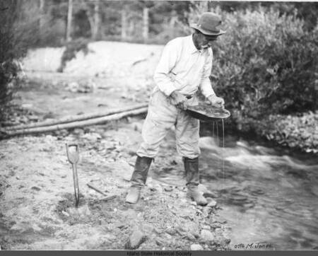
People who left home searching for gold to these isolated areas rarely had been documented, this area looks like the small hills of new centerville that is cut through by Grimes creek, and shows a lot about the tools and equipment gold panners like this pictured man had access to.

Hydraulic Mining

This shows how the sides of many rivers in the Boise Basin are eroded compared to other streams. This process used for gold mining is the reason why grimes creek is visible from the sky today not as a stream of life, but a barren and scarred path.
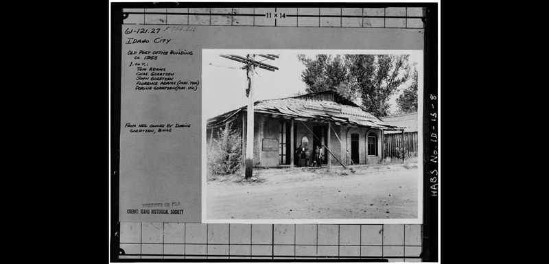
Old Idaho City Post Office Building

This building still stands today not as a post office but a museum, at the time of this photo the building was over 60 years old and everything but the brick walls were in serious disrepair. It was built with brick to avoid burning down like its predecessor.
Boise Basin Museum
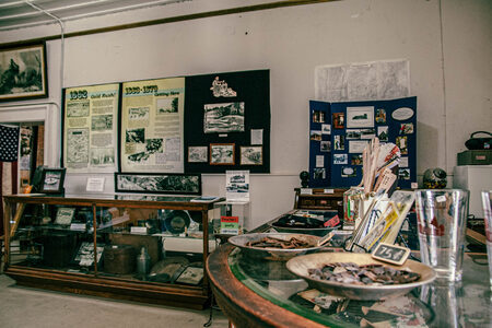
A lot of the history in the Boise Basin is contained here, objects found from historical sites are sold as nick nacks. This shows the results of many dig sites and photos gathered from descendants of current residents. This building is actually the old post office too.

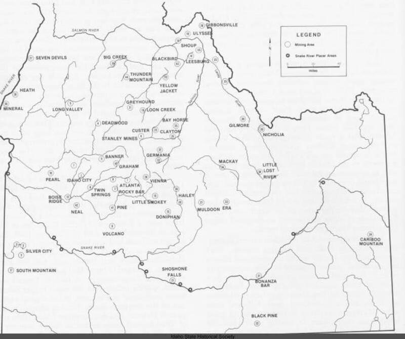
Index map of southern and central Idaho mining regions
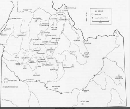
This shows how saturated the area was in mining regions, though it doesn't show the full extent of each area, it does show the activity tied to each river and the largest centers of mining. The density of sites are further shown by multiple sites on single rivers.